In 2010 the London Bat Group began to think about how to best utilise the large database of bat records that had been gathered thanks to the hard work of an army of London Bat Group members over the years. The Bat Group realised that raw database records in themselves are of little use without some sort of analysis. To be of use to those making decisions which affect bats in London (town planners, ecologists and land managers etc.), the data needed to be summarised in an easy to understand format. The solution – publish a London Bat Atlas.
In 2015 the atlas was published thanks to the tireless efforts of a number of London Bat Group members: Alison Fure (the project instigator), Richard Law (the atlas author) and Derek Coleman (the London Bat Group records officer) to name but a few.
The GiGL team were also instrumental to the project and were able to produce detailed distributed maps at 1km grid-square resolution.
The maps show:
- Different time periods
- Record type (roost, flight etc)
- Species distribution
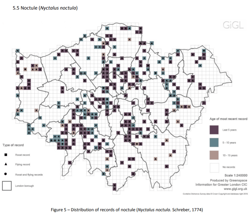
Visualising the bat records in this way has allowed us to understand how bats are using London more then ever before. Already the atlas has shown a few interesting trends. For example:
- Serotine bat seems to be concentrated to the south of London
- Leisler’s bat roosts appear to be highly localised
- Rare bat species, such as barbastelle & Bechstein’s bat, have not been recorded in London for many years
The London Bat Group hopes to use The Bat Atlas of London to galvanise support for bat conservation in the capital. Copies have been sent to all London authority planning departments and are available free-of-charge. We also hope to use the atlas to direct survey effort to areas of London where there are gaps in our knowledge of bat distribution and status.
For information on other projects funded by LBG, as well as how to get in touch if you have ideas for new projects that the bat group could get involved in, please click here.
Further Information
View and download The London Bat Atlas below.
